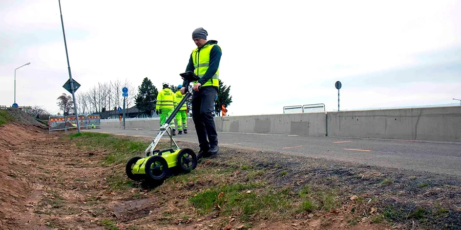
We were called to a site on Mathilda Avenue last year where a crew hit an uncharted 6-inch gas line during a shallow excavation. That near-miss pushed the developer to mandate a GPR survey before any further digging. Ground penetrating radar lets us map rebar, conduits, tanks, and voids without breaking pavement or soil. In Sunnyvale, where utility corridors are dense and old records are often incomplete, a GPR survey provides the quickest way to see what is actually underground. We work alongside calicatas exploratorias when ground truth is needed to calibrate radar reflections, especially in heterogeneous fill zones common across the city.
In Sunnyvale, where utility corridors are dense and old records are often incomplete, a GPR survey provides the quickest way to see what is actually underground.
Method and coverage
Sunnyvale sits on alluvial fan deposits from the Santa Cruz Mountains, so soil layers vary widely within a single block. Near the bay you find soft clays and silts; closer to Highway 85 the subgrade shifts to gravelly sands with cobbles. A GPR survey handles both extremes, but the dielectric contrast changes. In the clay-rich zones near Lakewood we pair GPR with a densidad cono de arena to correlate radar velocity with actual compaction. On the sandy side, the signal penetrates deeper and we can map multiple horizons. We always run a velocity calibration test on site because the dry summer soil and wet winter soil produce different travel times for the radar wave.
Technical reference image — Sunnyvale
Regional considerations
Sunnyvale developed rapidly from the 1950s onward. Old orchards were replaced by housing tracts and industrial parks, and many underground installations were never documented. The risk of striking an abandoned tank, a forgotten utility, or a collapsed culvert is real. A GPR survey reduces that risk by scanning the entire footprint before breaking ground. We have found old septic systems beneath parking lots and buried transformer vaults that were missing from as-built drawings. For rebar mapping in concrete slabs, GPR also helps avoid costly core drilling into post-tension cables. The city's seismic setting adds another layer of concern: loose fills amplify ground motion, and locating them early avoids foundation surprises.
Detect and mark buried pipes, conduits, cables, and tanks before excavation. Deliver CAD-ready plans with depths and horizontal positions.
02
Concrete Scanning & Rebar Mapping
Locate rebar, post-tension cables, conduits, and voids in slabs, walls, and bridge decks. Ideal for core drilling planning and structural assessment.
03
Environmental & Void Detection
Identify underground storage tanks, buried drums, sinkholes, and subsurface voids. Used for site characterization prior to remediation or construction.
Standards that apply
ASTM D6432-19 (Standard Guide for Using the Surface Ground Penetrating Radar Method), ASCE 7-22 (Minimum Design Loads and Associated Criteria for Buildings), OSHA 29 CFR 1926.651 (Excavation and Trenching Requirements)
Frequently asked questions
How deep can GPR see in Sunnyvale soils?
Depth depends on soil conductivity. In dry sandy soils near the foothills we reach 3 to 5 meters. In clay-rich zones near the bay, signal penetration drops to 1 to 2 meters. We always run a velocity calibration on site to adjust for local conditions.
Can GPR find plastic pipes and concrete vaults?
Yes, GPR detects contrasts in dielectric properties, not just metal. PVC pipes, concrete vaults, and even buried tree roots create reflections. We adjust antenna frequency and gain settings to optimize detection of non-metallic targets.
What is the typical cost for a GPR survey in Sunnyvale?
A standard utility location survey for a 10,000 sq ft lot typically ranges between US$8.64 and US$1.20 per square foot, depending on grid density and access. Concrete scanning is quoted per square foot of slab area. Contact us for a project-specific estimate.